1. Geographical location
Lai Chau is a Northwest border province of the country, 450 kilometers from Hanoi, geographical coordinates are from 21°51' to 22°49' North, from 102°19' to 103°59' East; the province’s North and Northwest borders with Yunnan Province of China, its West borders with Dien Bien Province, the East and the Southeast are adjacent to Lao Cai and Yen Bai, and next to the South of Lai Chau is Son La Province.
Lai Chau’s terrain is shaped by the Northwest - Southeast mountains ranges with numerous high peaks such as Pu Sa Leng (3096 m). The high and slopping hills are alternating with deep and narrow valleys. The Hoang Lien Son mountain range is located in the east and the Song Ma mountain range is in the West. Between them is a relatively large mesa of the Black River basin with 400km - long limestone plateaus stretching from Phong Tho (Lai Chau) to Quan Son, Quan Hoa (Thanh Hoa). The abundant numbers of plateaus, rivers and streams with high flows and numerous drops provide huge potentials of hydropower capability. Also, with 265.095 kilometers of border with China, Lai Chau plays an important geostrategic role in building and protecting the Socialist Republic of Vietnam.
In terms of climate, the characteristic tropical monsoon is clearly evident here with hot days and cold nights. The yearly weather is divided into two distinct seasons: a rainy season from May to September with high temperatures and humidity, and a dry season starts from November to March of the following year with the cold weather, low humidity and rainfall, annual temperatures range from 21ºC to 23ºC. Annual precipitation is averaged at about 2500-2700mm, unevenly distributed. The main wind directions are southeast and west, while the area is little affected by storms and Northeast monsoon.
2. Natural conditions and resources
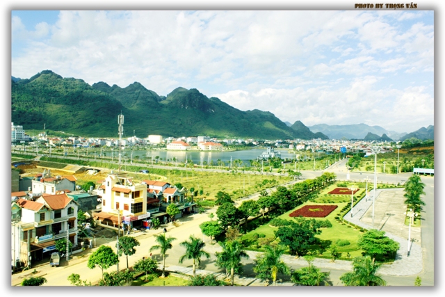
Lai Chau province has a natural area of 9068.78km2, with 8 administrative units: the city of Lai Chau and the districts of Muong Te, Sin Ho, Nam Nhun, Tam Duong, Phong Tho, Tan Uyen, Than Uyen; 108 commune-level administrative units including 96 communes, 05 wards and 07 towns (01 district, 03 communes and 02 wards were recently added).
The lands of Lai Chau consist mostly barren soil and yellow soil developed from sand, clay and limestone. The arable lands used for agricultural production are 84209.3 hectares, accounting for 9.28% of the province’s natural area.
The tropical forests and woodlands accounts for up to 35% of Lai Chau’s natural land, containing rich jungle flora including many valuable kinds of high-economic value timbers such as Chukrasia, Dalbergia Oliveri, Iron-wood, Hinoki… and many special spices, such as cardamom, lac, calamus, Zingiber zerumbet, along with many kinds of rare animals such as rhinos, gaurs, gibbons, tigers, peacocks, bears, etc.
- Water resource: Located in the upstream of Black River, the voluminous capacity of rainfalls creates a high density of rivers and streams, up to 5.5-6km per km2. There are many high capacity rivers and streams, such as:
+ Nam Na River (with the valley area of 2190 km2) flows through Phong Tho District, Tam Duong, and Northwest of Sin Ho with an average capacity 40-80 m3/s.
+ Nam Ma River flows through the low-land communes of Sin Ho District with the valley area of 930km2, with low slop and calm flow, average capacity of 50 m3/s
+ Nam Mu River flows along the Binh Lu valley, Than Uyen District with a 170 km2 basin area, the capacity is 8m3/s in dry season and 12-14m3/s in rainy season.
Surface water is not only a huge resource for agriculture and daily life but also an immense source of hydropower, powering several hydropower plants including Lai Chau (rated capacity of 1200MW, producing an average of 4704 million kWh per year), Huoi Quang (560MW), Ban Chat (200MW) and approximately 20 other small-sized hydropower plants with capacities ranging from 3 to 30MW.
- Lai Chau has over 120 mines distributed around the province, producing various kinds of mineral resources: rare earth (over 20 million tons) in Nam Me commune (Phong Tho District); ferrous metals (bronze, lead, zinc) with the capacity of 6000-8000 tons in Sin Cai, Ban Lang, Tam Duong District, steel ore (Huoi Luong, Phong Tho), bronze (Ma Ly Pho – Phong Tho), aluminum (Nam Ma – Sin Ho), gold in Chinh Sang, Ban Bo (Tam Duong), Noong Heo, Pu Sam Cap (Sin Ho), etc. There are also abundant construction materials like tile stone, limestone, marble and black stone. The limestone capacity is very high, their rich content of calcium oxide can help Lai Chau develop a large scale cement industry. Another mineral resource is mineral water found in Vang Bo, Muong So (Phong Tho), Na Nong, Na Don (Tam Duong), Vang Bo (Than Uyen), etc.
- The population of Lai Chau is around 403.2 thousand, with 20 ethnic groups in which there are 131,882 Thai people, account for 34%; 86,467 Mong people, account for 22.30%; 14,658 Ha Nhi people, account for 3.78%; 12,443 Giay people, account for 3.21%; 7464 Kho Mu people, account for 1.93%; 10,141 La Hu people, account for 2.62%; 6074 Lu people, account for 1.57%; 6,020 Lao people, account for 1.55%; 2,995 Mang people, account for 0.77%; 1,256 Cong people, account for 0.32%; 588 Hoa people, account for 0.15%; 546 Si La people, account for 0.14%; 161 Khang people, account for 0.04%; 295 Tay people, account for 0.08%; 116 Muong people, account for 0.03%; 180 Nung people, account for 0.05%; 27 Phu La people, account for 0.01%; 458 other people, account for 0.12% (figures dated from Dec 31, 2011).
- Traffic: mainly land-based. There is national road 12 crossing the province, connecting the city of Dien Bien Phu to China (through Ma Lu Thang border checkpoint) and national road 4D to Sa Pa town (Lao Cai Province). More importantly, Lai Chau is the crucial province connecting the Southeast China to the economic development triangle Hanoi – Hai Phong – Quang Ninh through several national roads (4D, 70, 32) and Black River waterway. In the 2006-2020 social-economic development orientation, the province has stated the following goals: survey and construct several small-sized airports, research and construct a railway route through Yen Bai – Van Chan – Mu Cang Chai – Than Uyen – Tam Duong to improve the traffic conditions from the province to others in the country.
Trọng Văn
Translator: Thu Phương